South Huntsville area file · July 2026
Bailey Cove is gaining connections. Their stages are easy to confuse.
A new multi-use path is in design, an established greenway already reaches Ditto Landing, Hays Farm parks are open, and Sandra Moon's final phase is not yet confirmed open. This file puts each piece on the right timeline.
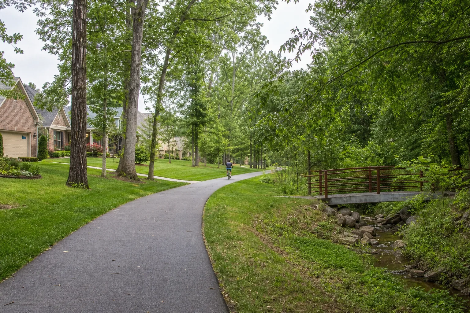
The useful South Huntsville story is not that a greenway is “coming.” It is that a north-south gap along Bailey Cove Road has moved into design while a larger set of paths, parks, schools, public facilities, housing, and retail destinations already surrounds the proposed route.
Those pieces are not all at the same stage. Aldridge Creek Greenway is open. The Park at Hays Farm and Hays Farm Sports Park are open. Parts of the Sandra Moon campus have opened in earlier phases, while the City's current facility page still describes the larger complex as a work in progress. The Bailey Cove multi-use path has funding and a design contract but no published construction schedule.
The reporting boundary
For this article, “South Huntsville and Bailey Cove” is an editorial reporting area centered on Bailey Cove Road between Weatherly Road and Four Mile Post Road. It also follows named project connections along Weatherly Road, Haysland Road, Elgie's Walk Greenway, Aldridge Creek Greenway, and the public facilities immediately tied to those routes.
This is not a legal neighborhood boundary. It does not imply that every address is in the same subdivision, civic association, school zone, ZIP code, council district, flood area, or service area. Use the City's GIS map gallery and My Huntsville Services for parcel- and address-level questions.
The housing record shows established reinvestment and recent delivery
The City's 2025 Development Review said residential renovation activity remained strong in south Huntsville. That is useful evidence of work on existing homes, but the published summary does not give a Bailey Cove-specific permit count or identify the mix of additions, alterations, repairs, and other permit types. A future renovation story will need permit-level records before it can compare individual neighborhoods.
The same annual report shows a different form of activity around Haysland. Census tract 28.01 recorded 350 new-housing certificates of occupancy during 2025: 318 multifamily units and 32 single-family or townhome units. That made Haysland one of Huntsville's five highest-delivery reporting tracts for the year. The citywide distribution is reconciled in our 2025 housing-completions analysis.
A certificate of occupancy is authorization to occupy newly completed construction. It is not proof that every unit was leased, sold, listed, or occupied at year-end. The tract is also a Census reporting geography, not a subdivision boundary. Its 350-unit total should not be assigned to one building or used as a count for the entire Bailey Cove corridor without project-level certificate records.
The defensible housing read is mixed: documented reinvestment in existing south Huntsville homes and concentrated new delivery in the broader Haysland tract.
The 2.4-mile Bailey Cove path is funded and in design
In November 2025, the City authorized a federal Transportation Alternatives Program application for a 2.4-mile, 12-foot-wide, ADA-compliant multi-use path. The described route runs north-south along Bailey Cove Road from Weatherly Road, then east-west along Four Mile Post Road toward an Aldridge Creek Greenway connection.
The February 2026 project announcement placed the estimated total cost at about $1.8 million, including roughly $800,000 in TAP funding. The City's November grant action identified a $1,030,750 local contribution. Those numbers describe the estimated funding structure, not a final construction invoice.
City Council advanced the next step on May 14, approving a $149,521 design contract with Three Notch Group for the Bailey Cove path between Weatherly and Four Mile Post. That is the latest project-specific contract located for this review.
No City source reviewed through July 22 announced final engineering, a construction bid, notice to proceed, groundbreaking, or opening date. The correct status is in design. The February announcement says construction timing will be released after final engineering and coordination with the Alabama Department of Transportation. Our earlier Bailey Cove and Miller Branch explainer compares the funding and intended network connections of the two projects.
The Blevins Gap intersection is part of the scope
The project includes safety changes at Bailey Cove Road and Blevins Gap Road. The City lists improved crosswalks, accessible pedestrian signals, traffic-calming measures, and intersection adjustments intended for people walking, cycling, and driving.
Those elements are planned, not installed. The final design will be the reliable record for precise crossing geometry, signal placement, traffic-control details, right-of-way needs, and construction phasing.
Aldridge Creek is open; the Bailey Cove link is meant to reach it
The City's current location page lists Aldridge Creek Greenway as a 5.49-mile existing path running from about one-half mile south of Weatherly Road to Ditto Landing. It names the Sandra Moon Complex, Mountain Gap schools, Challenger schools, and Ditto Landing among nearby destinations, with parking at Ken Johnston Park and Ditto Landing.
The proposed Bailey Cove route would create an alternate north-south connection and then turn along Four Mile Post Road toward that established trail. It should not be described as an extension already open to the public.
Farther south, the City awarded a $1.5 million construction contract in October 2025 for a 1.5-mile Tennessee River Greenway segment between Green Cove/Buxton and Hobbs/Redstone roads. The City said that segment would complete a 15-mile loop using the Weatherly Road multi-use path and Aldridge Creek Greenway, while also connecting to the Haysland Road network. That construction project is related network context, but it is separate from the Bailey Cove design contract.
Haysland Road already carries a second greenway spine
Elgie's Walk Greenway opened in 2020 along Haysland Road between Grissom High School and Bell Mountain Park. It now connects the parks and development around Hays Farm into the broader walking and cycling system. The City's sources have used slightly different mileage descriptions for Elgie's Walk over time, so this file does not use a single mileage as a headline fact.
A separate $134,984 design contract approved in May 2026 covers a Jackson Bend connector with Haysland Road. The City announcement identifies the contract but does not give enough detail to place that work on the same route or schedule as the Bailey Cove path. It remains a separate design-stage project.
Area status board
Six connections, six verified stages
The status board separates what can be used now from what still needs design, construction, or an opening record.
| Place or project | Verified stage | What the record establishes | Next update trigger |
|---|---|---|---|
| Bailey Cove multi-use pathWeatherly Road to Four Mile Post Road | In design | 2.4-mile project has TAP funding and a $149,521 design contract. | Final engineering, ALDOT coordination, bid, notice to proceed, or construction schedule. |
| Bailey Cove / Blevins GapIntersection safety scope | Planned in design | Crosswalk, accessible-signal, traffic-calming, and intersection changes are part of the project description. | Final plans or a construction contract identifying the delivered scope. |
| Aldridge Creek GreenwayWeatherly area to Ditto Landing | Open | City location page lists 5.49 existing miles and current access points. | Official extension, closure, detour, or map revision. |
| The Park at Hays Farm801 Haysland Road | Open | Nine-acre park opened December 4, 2025, with paths and an Elgie's Walk connection. | A City operations, access, or amenity update. |
| Hays Farm Sports ParkHaysland Road | Open | Two regulation-size multi-use fields and supporting facilities opened in 2024. | A City access, scheduling, or facility update. |
| Sandra Moon final phase7901 Bailey Cove Road | Nearing completion | June 26 update said a ribbon cutting was weeks away; current facility page still says work in progress. | Official ribbon cutting, public hours, program schedule, or completion announcement. |
Status reviewed July 22, 2026. An anticipated opening is not treated as an opening until a current public record confirms it.
The public destinations are arriving in phases
Sandra Moon has open components and an unfinished final phase
The South Huntsville Public Library opened in September 2021 at the north end of the former Grissom High School campus. The 30,750-square-foot library includes study, classroom, makerspace, meeting, children's, teen, outdoor, and technology spaces. The campus added an ADA-accessible playground in December 2023 and an arts wing in February 2024.
The City's June 26, 2026 update said the final construction phase was nearing completion and described an auditorium for about 600 people, an event center for about 300, adaptive-recreation space, refreshed gyms, a multimedia area, fitness center, and indoor walking path. It said a ribbon cutting was only weeks away.
That projected milestone has not been converted into a confirmed opening here. The current facility page still calls Sandra Moon a work in progress, lists the gym for scheduled activities, shows no general public hours, and marks several spaces under renovation. Individual campus components can be open even while the final phase remains incomplete.
The Hays Farm parks are current amenities, not future renderings
Hays Farm Sports Park opened in 2024 with two regulation-size multipurpose fields, lighting, a restroom pavilion, parking, perimeter fencing, landscaping, and irrigation. The nine-acre Park at Hays Farm opened December 4, 2025 at 801 Haysland Road. Its City-listed amenities include a gazebo, pavilion and restrooms, water feature, relocated farm windmill, fitness court, and walking paths linking to Elgie's Walk.
The distinction from Sandra Moon matters. The Hays Farm parks have opening records. Sandra Moon's final phase has a near-completion update. The Bailey Cove path has a design contract. Readers should not collapse all three into a single claim that “everything is open” or “everything is coming.”
What to watch next
A construction contract for Bailey Cove
The next decisive record will be final design completion, ALDOT coordination, a bid award, or a notice to proceed. That record should establish a firmer cost, construction limits, traffic impacts, and schedule.
The actual Sandra Moon opening
The June projection is now a monitoring item. An official ribbon-cutting notice, revised facility hours, or public program schedule will move the final phase from “nearing completion” to open.
Project-level housing delivery
The Haysland tract total establishes concentrated 2025 delivery, but not the present inventory or occupancy of individual properties. Permit and certificate records are needed to assign units to projects and to distinguish Hays Farm construction from the broader tract.
How the three greenway pieces meet
The Bailey Cove path, Aldridge Creek Greenway, and the southward Tennessee River Greenway project are related as a network. Their exact handoffs, construction phasing, detours, and opening dates should be mapped only from final City or ALDOT plans.
Primary sources
- City of Huntsville, Bailey Cove TAP grant action and route description, November 20, 2025.
- City of Huntsville, Bailey Cove multi-use path scope and estimated cost, February 12, 2026.
- City of Huntsville, Bailey Cove and Jackson Bend design contracts, May 14, 2026.
- City of Huntsville, Aldridge Creek Greenway location, length, and access.
- City of Huntsville, Tennessee River Greenway Phase III construction contract, October 23, 2025.
- City of Huntsville, Elgie's Walk Greenway opening, December 9, 2020.
- City of Huntsville, The Park at Hays Farm opening, December 4, 2025.
- City of Huntsville, Hays Farm Sports Park opening and Sandra Moon phase context, January 10, 2025.
- City of Huntsville, Sandra Moon final-phase update, June 26, 2026.
- City of Huntsville, current Sandra Moon facility status, reviewed July 22, 2026.
- City of Huntsville, South Huntsville Public Library opening, September 28, 2021.
- City of Huntsville, 2025 Development Review, housing completions and renovation context.
- City of Huntsville, GIS map gallery.
This area file is informational. It does not define a legal neighborhood, verify a specific address, estimate property value, or replace current planning, permit, title, survey, school-boundary, flood, insurance, or service records.